Winter storm brings ice, heavy snow Monday night into Wednesday
Freezing rain with periods of heavy snow develop Monday night south

Go Deeper.
Create an account or log in to save stories.
Like this?
Thanks for liking this story! We have added it to a list of your favorite stories.
Updated: 5:20 p.m.
A wintry mix of snow and freezing rain showers develop Monday night into Tuesday with the heaviest snow falling Tuesday. Snow showers will linger into early Thursday, making this a prolonged event.
Another impactful winter storm develops
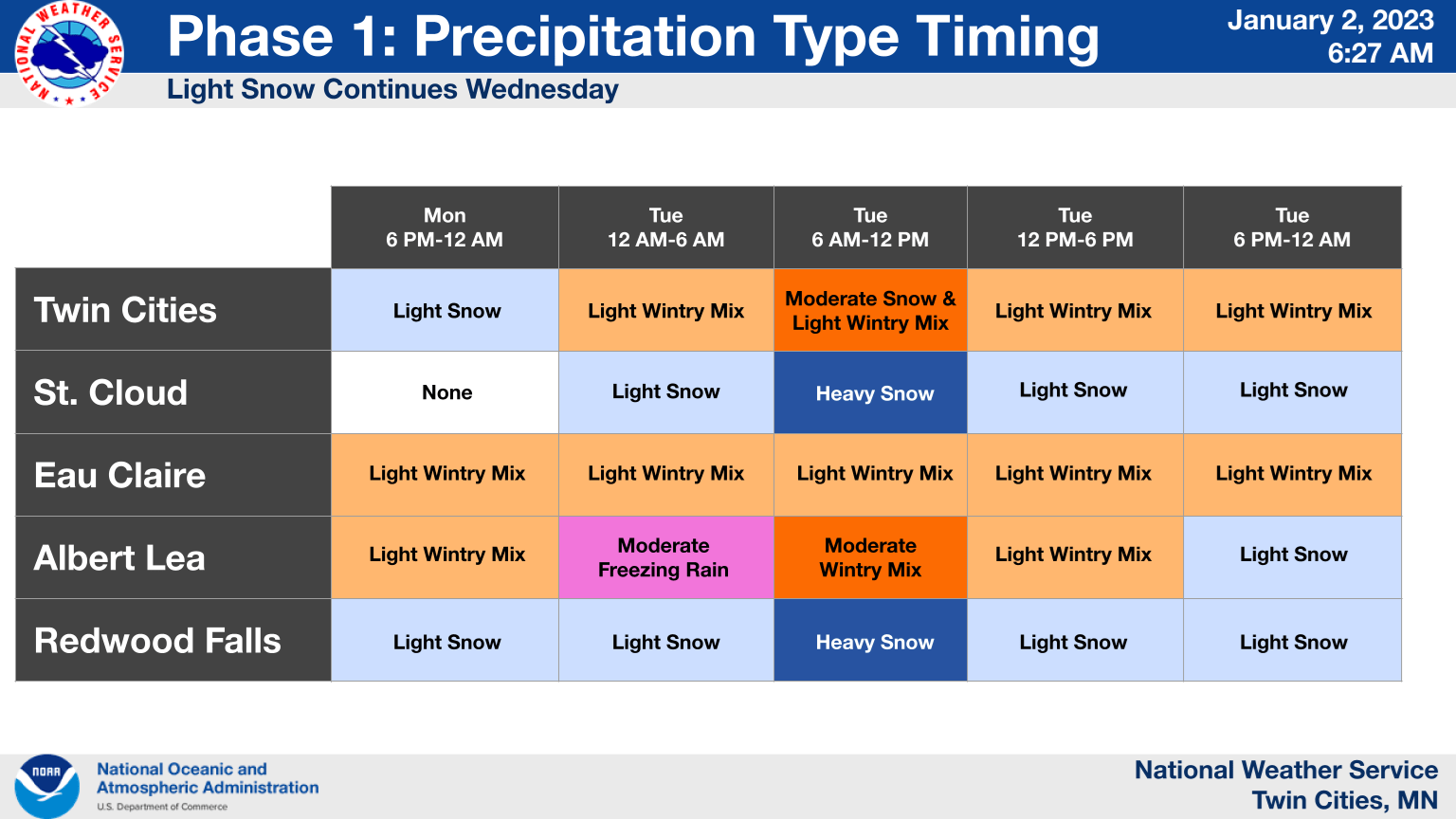
A messy winter storm will impact the southern half of Minnesota and portions of northeast Minnesota late Monday into early Thursday. A wintry mix of heavy snow and freezing rain and rain will be possible from the Twin Cities and points south and southeast Tuesday.

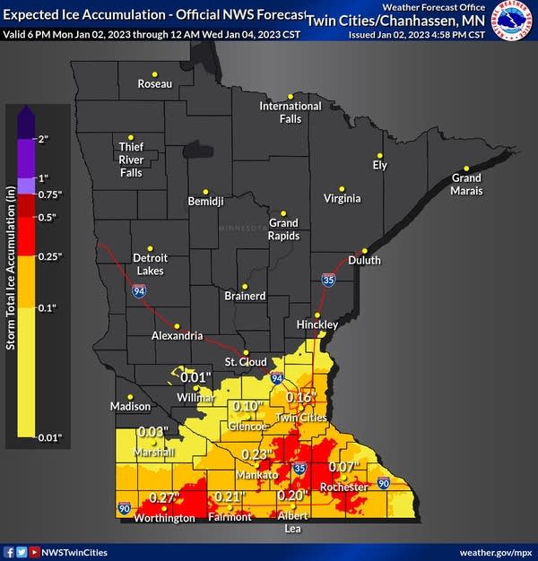
There could be significant ice accumulation for portions of south central and southeast Minnesota late Monday night into Tuesday. There are ice storm warnings for portions of south central and southeast Minnesota.

Here is a break down of precipitation type and intensity for various locations impacted by the winter storm:


Snow totals will be heaviest in southwest Minnesota and be less farther east where mixed precipitation types will cut back to totals some.

Behind the system colder air, but not arctic air will move in. High temperatures by late in the week and weekend will be mainly in the teens with overnight lows in the single digits and even some subzero readings in northern Minnesota.

Turn Up Your Support
MPR News helps you turn down the noise and build shared understanding. Turn up your support for this public resource and keep trusted journalism accessible to all.
Dear reader,
Political debates with family or friends can get heated. But what if there was a way to handle them better?
You can learn how to have civil political conversations with our new e-book!
Download our free e-book, Talking Sense: Have Hard Political Conversations, Better, and learn how to talk without the tension.


