Wettest winter on record erased drought in eastern Minnesota
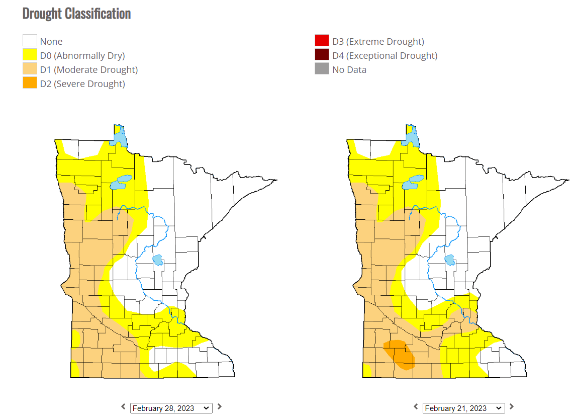
Moderate drought lingers across western Minnesota.

Go Deeper.
Create an account or log in to save stories.
Like this?
Thanks for liking this story! We have added it to a list of your favorite stories.
“It takes a flood to end a drought.” -Mark Twain
Mark Twain is credited with some astute weather quotes. And while we may not have a flood yet in most of Minnesota, the amount of moisture we’ve received this winter has reached record levels across most of our state.
This was the wettest meteorological winter on record for most of Minnesota and the Upper Midwest. The regions with a 1 indicate the wettest winter on record going back to 1893.

There’s now 2 to 6 inches of water sitting in the snowpack across Minnesota and Wisconsin. Check out the 6.5-inch Snow Water Equivalent (SWE) reading near Hayward, Wisconsin.

Spring melt rates matter
Because the ground is still mostly frozen, most of that water still has yet to be “realized” in soils across Minnesota.
Turn Up Your Support
MPR News helps you turn down the noise and build shared understanding. Turn up your support for this public resource and keep trusted journalism accessible to all.
Here’s more detail from the Midwest discussion in this week’s U.S. Drought Monitor.
This has been a particularly wet winter for the Upper Midwest. But previous months, especially last summer, were dry and hot, which dried the soils. As winter set in, the soils froze and the dry condition was locked into place. The soils in the Upper Midwest are still frozen, so the benefits of the recent precipitation, which is laying as a deep snow cover, won’t be realized until the soils thaw and the snow meltwater soaks into the ground.
A faster melt will send more of that water in our snowpack into rivers and lakes. A slower melt will allow more to soak into gradually thawing soils.
Forecast: More moisture ahead Sunday and Monday
Our weather pattern looks mostly quiet into early Sunday. A little freezing fog may occur Friday morning.
Highs Friday and Saturday will thaw into the 30s across most of Minnesota.

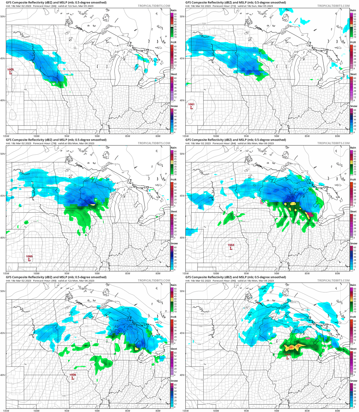
By Sunday, our next sloppy weather system approaches. This one looks warm enough for a slushy-type snowfall. Models vary right now, it could be a slushy inch or two, to a few inches of wet March snow.
NOAA’s GFS model loop below gives you an idea of potential rain and snow zones between 6 am Sunday and noon Monday.

The European model is one of several that lay out another soaking shot of moisture Sunday and Monday.

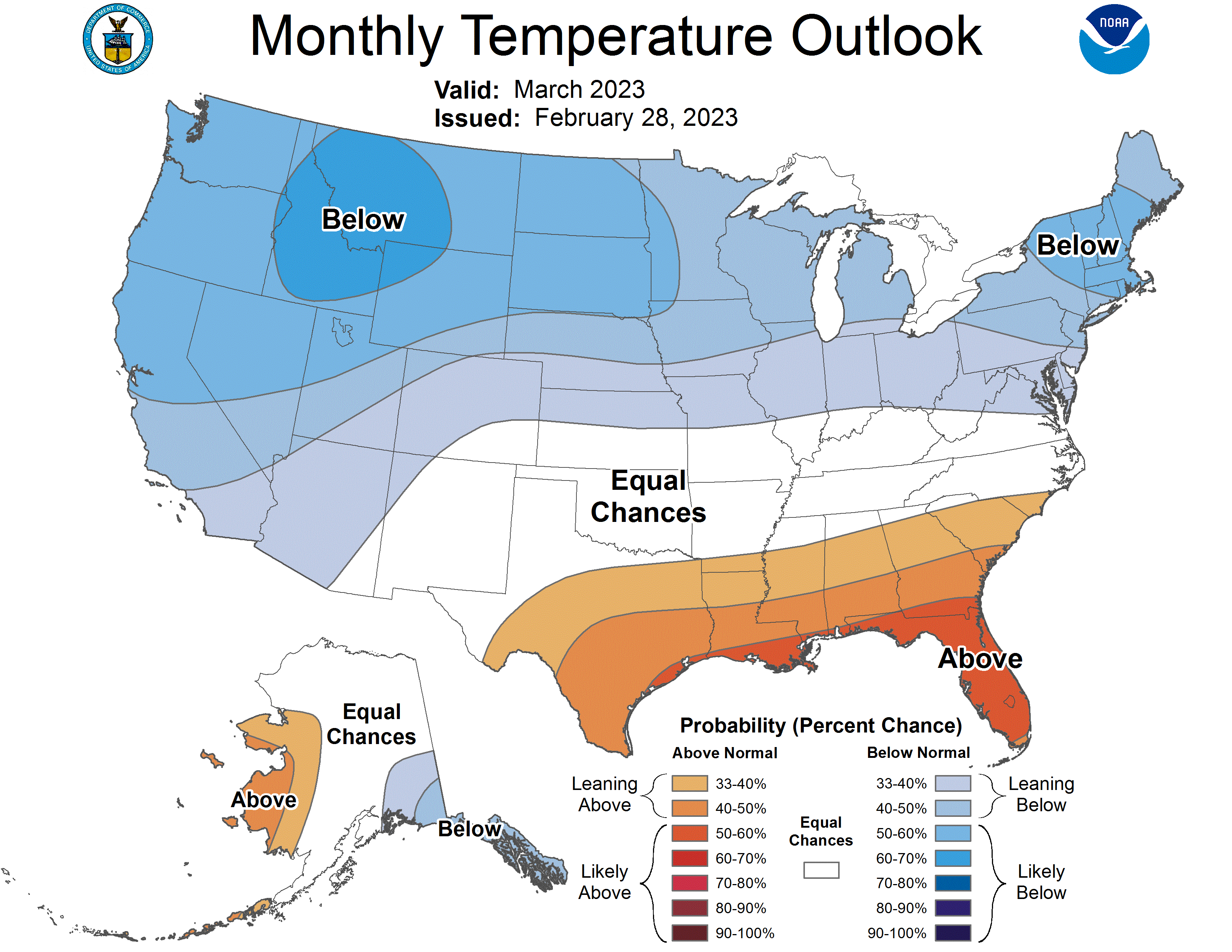
The NOAA March temperature outlook favors colder-than-average temperatures this month.

But it’s interesting to note that NOAA’s CFS2 longer-range temperature outlooks favor warmer than average temperatures for the month of April.

A warmer-than-average April for Minnesota? A (weather) guy can dream.
Stay tuned.
Dear reader,
Political debates with family or friends can get heated. But what if there was a way to handle them better?
You can learn how to have civil political conversations with our new e-book!
Download our free e-book, Talking Sense: Have Hard Political Conversations, Better, and learn how to talk without the tension.


