Mild Wednesday before the next winter storm moves in Thursday
Highs will be in the 40s and 30s Wednesday

Go Deeper.
Create an account or log in to save stories.
Like this?
Thanks for liking this story! We have added it to a list of your favorite stories.
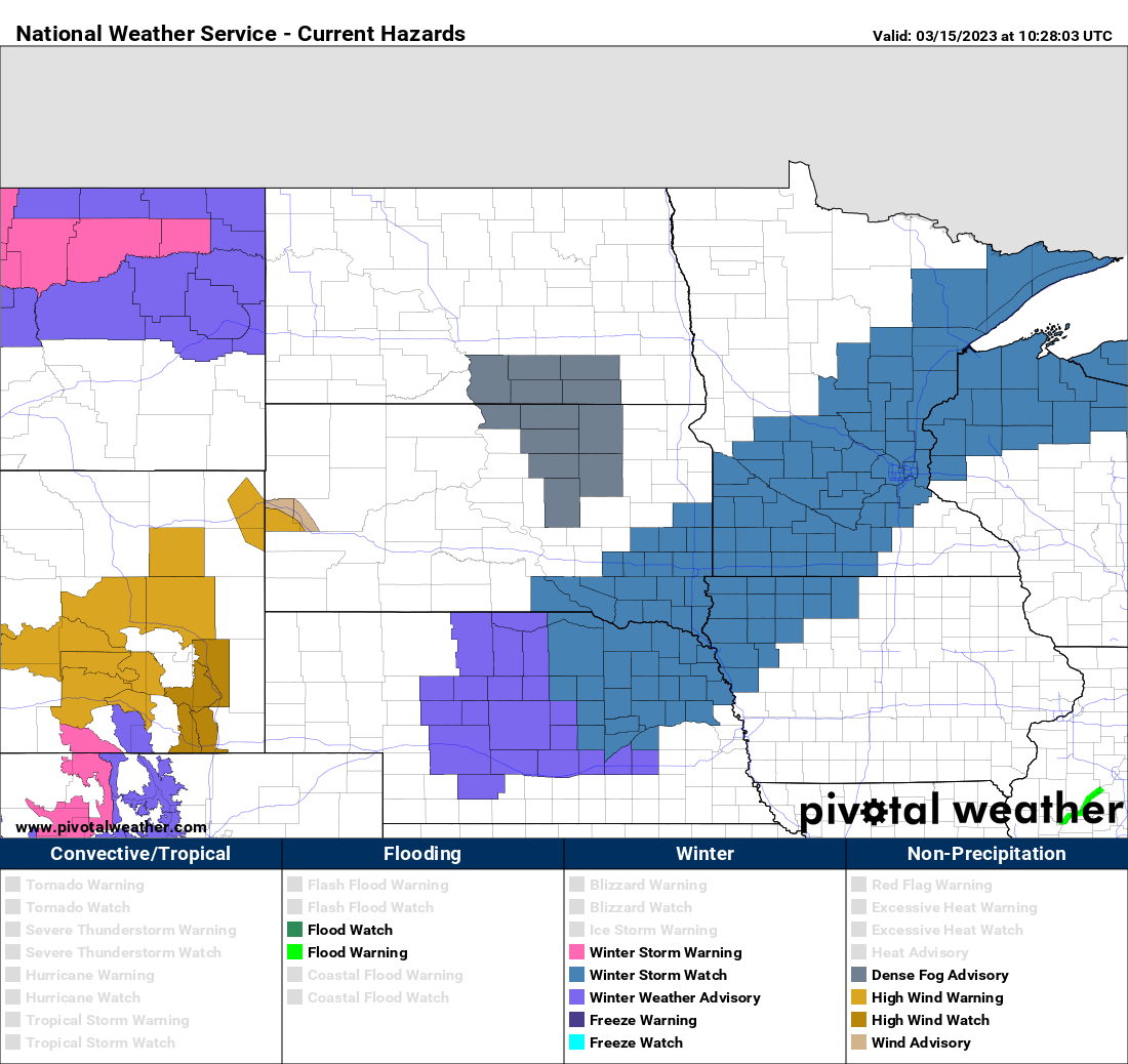
Temperatures will be warmer Wednesday ahead of our next winter storm. Rain and snow will develop for northern Minnesota Wednesday night and southern Minnesota early Thursday into Friday. A winter storm watch goes into effect Thursday.
Mild Wednesday with increasing clouds
Look for a mild day Wednesday. Morning temperatures were already much warmer than just 24 hours ago. Parts of northeast Minnesota which were subzero early Tuesday were more than 30 degrees warmer early Wednesday.

Highs will be in the 40s for much of eastern and southern Minnesota Wednesday afternoon. Cloud cover will increase and thicken up ahead of the next round of moisture through the day.

If the Twin Cities can surpass 45 degrees, it’ll be the warmest day in 109 days when it was last above that point on November 27th.
Turn Up Your Support
MPR News helps you turn down the noise and build shared understanding. Turn up your support for this public resource and keep trusted journalism accessible to all.
How well can the snow accumulate Thursday?
A winter storm watch is posted for a swath of Minnesota, going into effect midday Thursday into early Friday.

The first round of rain and snow will move across northern Minnesota Wednesday night ahead of the main storm system. This will be followed by a surge of rain and snow coming in from the southwest early Thursday, moving northeast into early Friday.

The first round of snowfall will bring a coating to as much as 2 or 3 inches in northern Minnesota into early Thursday.

The complication for snowfall in southern Minnesota will be warm temperatures and precipitation starting as rain, turning to snow Thursday afternoon. You can see temperatures remain above freezing up until the late afternoon or even evening hours Thursday.

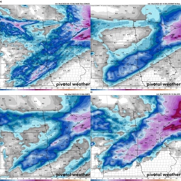
As we’ve seen in the previous couple snowfalls, this makes it difficult for even heavy snow to accumulate at rates it would in colder, midwinter scenarios. Aside from that, some models aren’t putting out a lot of snowfall while a couple are.

Keep in mind the models can’t really account for compacting and melting of snow as it falls also. I think most of the Twin Cities will see 2 to 4 inches with 5 inches on the high end. Northeast Minnesota stands to see the most where Duluth and the North Shore will likely see 6 to 12 inches.
The official forecast from the National Weather Service calls for higher totals.

We’ll see chilly air behind the system with temperatures only in the 20s Friday and Saturday for highs.


