

Snow showers north Tuesday; snow, rain, thunder Thursday into Saturday
Colder Wednesday before warming ahead of rain Thursday

Go Deeper.
Create an account or log in to save stories.
Like this?
Thanks for liking this story! We have added it to a list of your favorite stories.
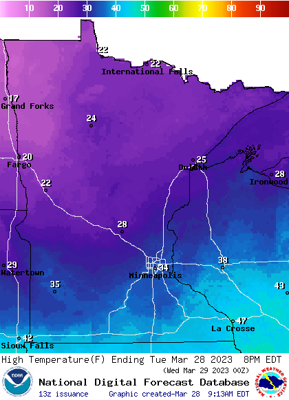
Northern Minnesota gets a fresh coating of snow Tuesday. Wednesday’s colder statewide with subfreezing highs. Rain, snow and even thunder develop late Thursday into Saturday.
Snow showers for northern Minn., then colder
Snow showers will continue to spread east across northern Minnesota Tuesday with sunshine south through the morning.

Most snowfall will be light but there could be some heavier, quick bursts of snow or snow squalls Tuesday afternoon in northeastern Minnesota.

Temperatures will continue to be below normal with highs near 40 in far southern Minnesota to just teens in northwestern Minnesota Tuesday afternoon.
Turn Up Your Support
MPR News helps you turn down the noise and build shared understanding. Turn up your support for this public resource and keep trusted journalism accessible to all.
We’ll have a brief shot of even colder temperatures behind the Tuesday clipper system. Temps will dip below zero across northern and western Minnesota Tuesday night.

High temperatures Wednesday will be 10 to 25 degrees below normal and subfreezing nearly statewide.

Rain, thunder, snow late Thursday
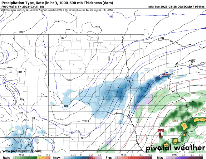
Showers and even thunderstorms develop late Thursday into Thursday night across southern Minnesota with rain and snow in northern Minnesota.
There’s even a general (low) risk of some severe storms with mainly a large hail threat Thursday night along far southern Minnesota.

The best chance of accumulating snowfall Thursday night will be in northern Minnesota.

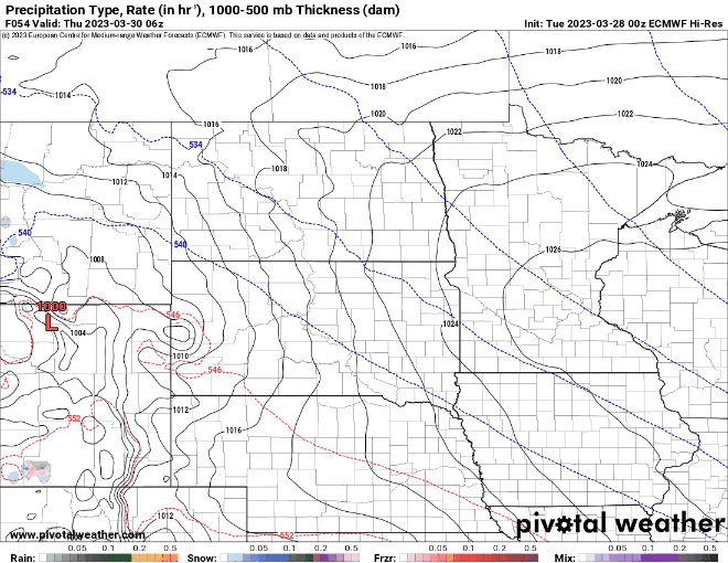
Late Friday rain turns to snow across southern Minnesota with the possibility of snow somewhere in central or southern Minnesota.
There remains uncertainty with this second round of potential snowfall.

Dear reader,
Political debates with family or friends can get heated. But what if there was a way to handle them better?
You can learn how to have civil political conversations with our new e-book!
Download our free e-book, Talking Sense: Have Hard Political Conversations, Better, and learn how to talk without the tension.

