Warm, mostly dry Memorial Day; Unsettled rest of the week
Go Deeper.
Create an account or log in to save stories.
Like this?
Thanks for liking this story! We have added it to a list of your favorite stories.
Updated: 3 p.m.
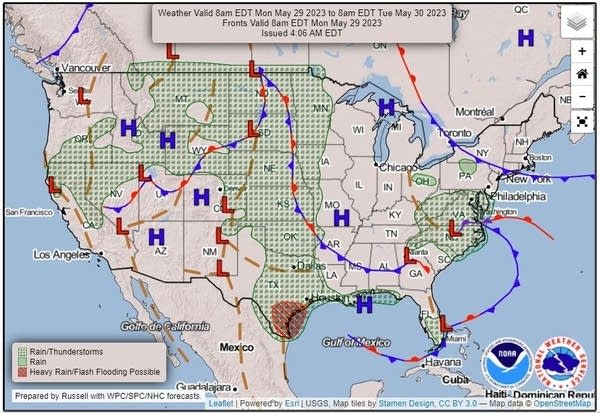
The dry high pressure over the Great Lakes that has been bringing us dry, toasty weather will begin to slip slowly eastward today. Replacing it will be a series of loosely-organized weather systems from the west that will bring us hit-and-miss showers and thunderstorms for much of the upcoming week. Temperatures will remain much warmer than normal.
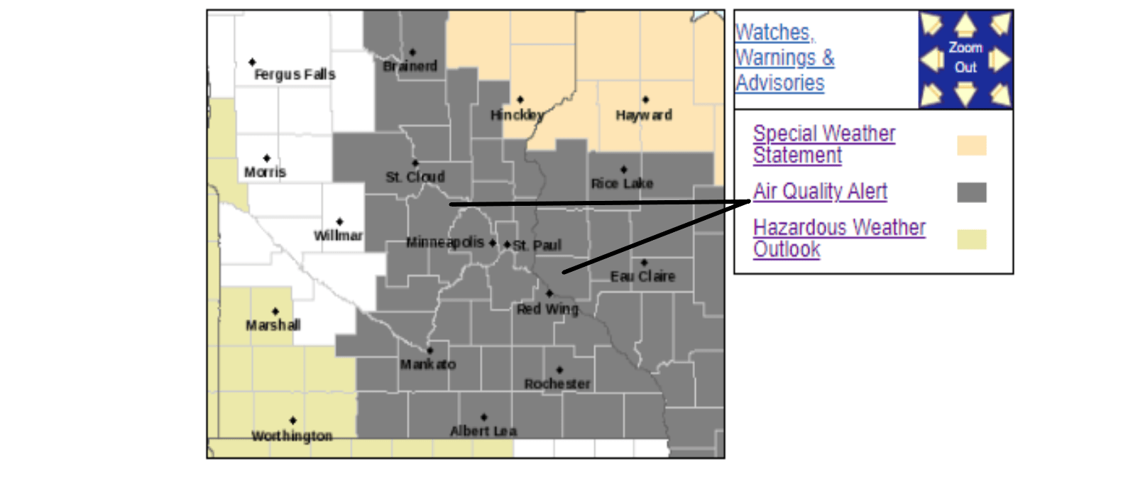
Parts of northeastern Minnesota are under a fire danger warning until 8 p.m. Monday, the National Weather Service says, caused by low humidity coupled with southerly winds. Air quality alerts are also issued until tonight due to ground-level ozone in areas of Minnesota.
Great Memorial Day weather for a lakeside picnic
Temperatures will be on the rise again for Memorial Day. Expect afternoon high temperatures in the 80s for most of Minnesota and western Wisconsin. The Twin Cities should see a high near 86 with a light breeze of around 10 mph from the south-southeast. A coolish breeze off an area lake might feel good. Cooler temperatures will be on tap for the North Shore where a breeze off chilly Lake Superior will certainly be evident.
Air quality alerts for ground-level ozone will be in effect through Monday evening for large areas of central and southeastern Minnesota and much of western and southern Wisconsin. Sunshine and warm, dry conditions cause a chemical reaction between pollutant volatile organic compounds and nitrogen oxides to produce ozone. While ozone high in the atmosphere protects us from excessive ultraviolet radiation, ground-level ozone is a pollutant that can impact sensitive people.
Turn Up Your Support
MPR News helps you turn down the noise and build shared understanding. Turn up your support for this public resource and keep trusted journalism accessible to all.

As the western weather ripples spread east, scattered thunderstorms should pop across parts of western Minnesota Monday afternoon and into the evening. Some weakening showers and storms will spread east overnight and could reach the Twin Cities late Monday night.

There is a marginal (level 1 of 5) risk of severe weather for most of South Dakota and Nebraska for Monday into Monday night. This marginal risk area includes just a sliver of the western edge of Minnesota along the South Dakota border.

Stormy periods this coming week
Many of us could use some rain for our lawns, gardens, parks and farm fields. And it looks like it’s finally on its way. Those disorganized weather systems approaching from the west will pump more humidity our way and provide the energy to grow widely scattered showers and thunderstorms from Tuesday through much of the week. Daily heating will often be the trigger to get the action going during the warm afternoons that will continue.
Possibly the greatest chance of strong storms could be later on Tuesday. The Storm Prediction Center has issued a marginal risk for much of Minnesota, including St. Cloud and the Twin Cities, and a bit of western Wisconsin. Isolated strong to severe thunderstorms with marginally severe hail and gusty winds are possible Tuesday afternoon and evening.

How much rain will fall?
Forecasting rainfall amounts from scattered showers and storms is challenging. Will showers strike here-and-there or hit the same spots multiple times? The Weather Prediction Center takes a shot at such things. Their forecast for rainfall amounts for the 72 hours ending at 7 a.m. on Thursday indicates that some areas, mainly in the southern half of Minnesota, could pick up an inch or more of rain.

Summerlike heat will continue
Toasty temperatures will continue all week. High temperatures will be primarily in the 80s, with some spots cracking the low 90s at times. As is often the case, the North Shore will be cooler.


