Forecast models suggest heaviest weekend rainfall favors western Minnesota
Sharp cutoff in rainfall possible across eastern Minnesota

Go Deeper.
Create an account or log in to save stories.
Like this?
Thanks for liking this story! We have added it to a list of your favorite stories.
Soaking rain is in the forecast this weekend. But the big question is where?
Forecast model trends continue to favor the heaviest rainfall zone across the Dakotas and western into central Minnesota.
The outlook for eastern Minnesota into Wisconsin suggests significantly less rainfall. Several forecast solutions suggest there may be a sharp cutoff in rainfall across eastern Minnesota.
The system
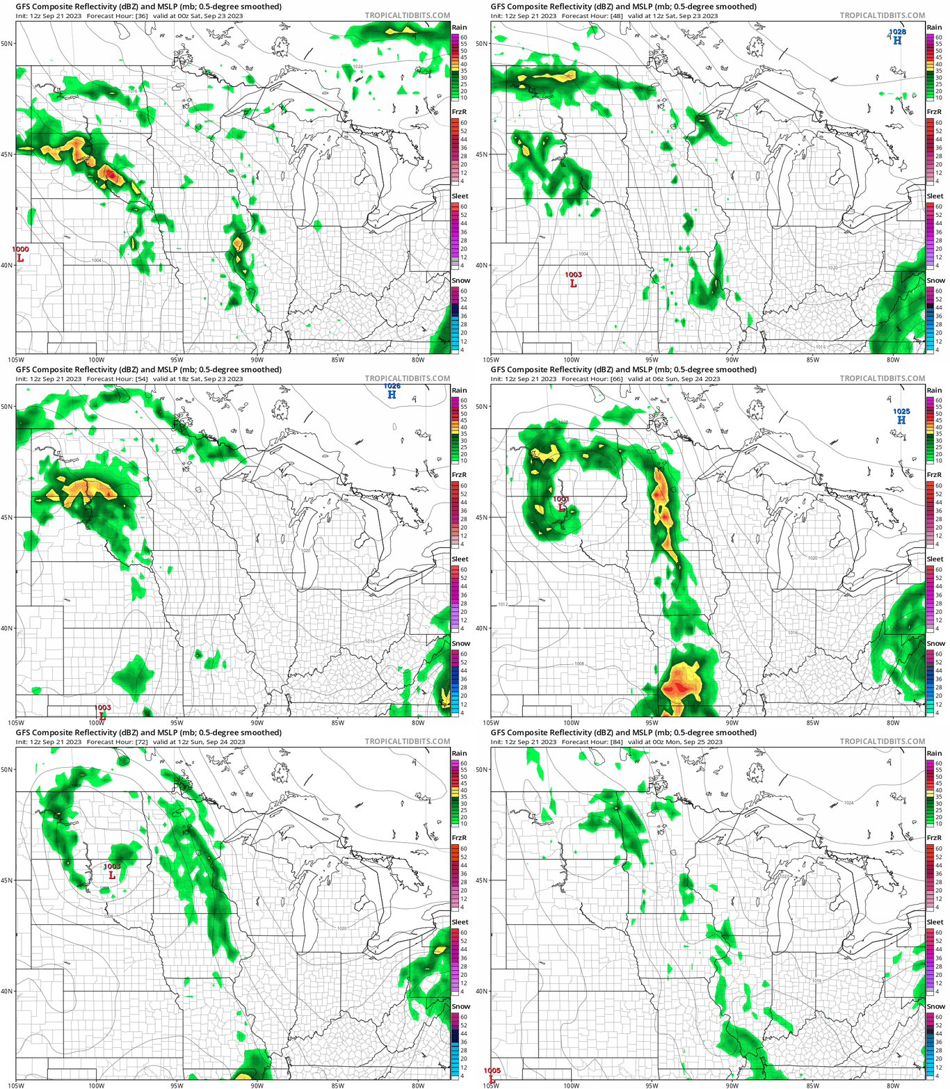
The National Oceanic and Atmospheric Administration’s Global Forecast System model is similar to most models. It shows the low-pressure system spinning through the Dakotas this weekend.
Turn Up Your Support
MPR News helps you turn down the noise and build shared understanding. Turn up your support for this public resource and keep trusted journalism accessible to all.
Scattered rain and thunder favor areas closer to the low in the Dakotas and western into central Minnesota. Note how rainfall is less focused on the Twin Cities and eastern Minnesota.
The forecast model loop below runs between 7 p.m. Friday and 7 p.m. Sunday.

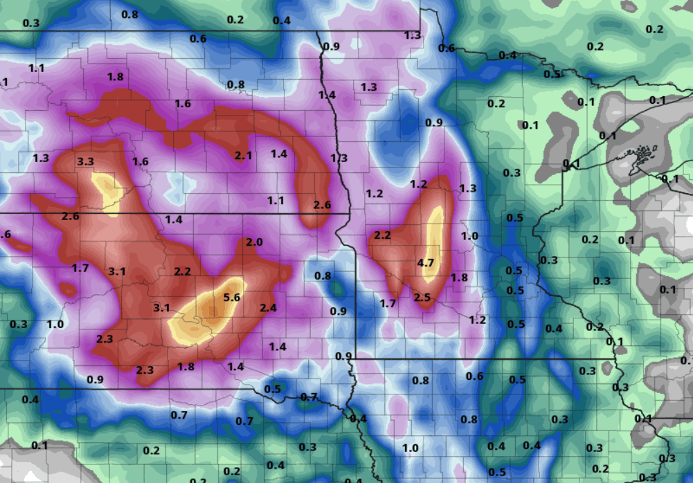
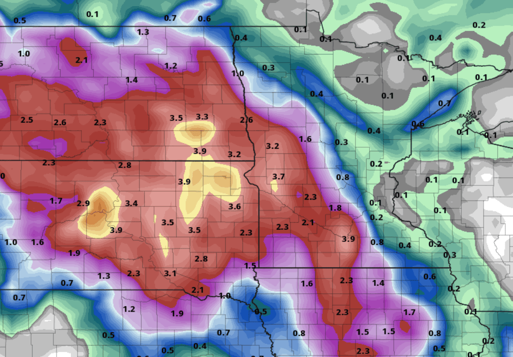
Thursday’s forecast model runs continued to show the likely westward rainfall drift. The European Centre for Medium-Range Weather Forecasts model lays out a multi-inch rainfall zone of between 3 and 5 inches as close to the Twin Cities as Willmar.

NOAA’s Global Forecast System model has a remarkably similar rainfall bull’s-eye over west-central Minnesota around Willmar.

The Canadian model also lays out a wide zone of 1 to 3-inch rainfall potential across central and western Minnesota.

The sad news is that if current model trends are verified, the Twin Cities area and eastern Minnesota will receive much less rainfall. Many solutions keep the Twin Cities at or well under an inch of rain this weekend.
Stay tuned.


