A wet weekend for much of Minnesota shaping up
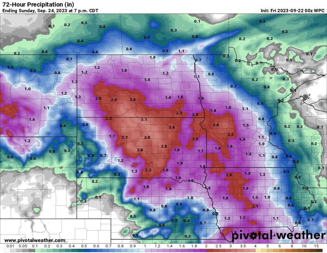
The heaviest rainfall will be in western Minnesota

Go Deeper.
Create an account or log in to save stories.
Like this?
Thanks for liking this story! We have added it to a list of your favorite stories.
A large storm system will be bringing rain and even potentially severe weather to parts of Minnesota over the weekend. The heaviest rainfall looks likely west.
Warm and mainly dry Friday before rain develops
Friday will be warm in southern Minnesota while northern Minnesota will see some spotty showers and thunder. Highs will be well into the 70s for most of the state Friday afternoon. Showers and thunder are possible later in the day south also.

Showers and thunderstorms then develop in waves around a low to the west that will bring the first round of activity to the west and southwest overnight Friday night into Saturday morning.

Later in the day storms develop again, some could be severe. There’s a slight risk of severe weather Saturday and even a marginal risk late Friday.

That round of moisture will then attempt to track north and east. The Twin Cities best chance of rainfall will come in that Saturday night into Sunday time frame. Showers will linger in parts of the state into Monday and Tuesday. Rainfall totals overall will be heaviest west with little rainfall in northeast Minnesota.

Turn Up Your Support
MPR News helps you turn down the noise and build shared understanding. Turn up your support for this public resource and keep trusted journalism accessible to all.


