

Wintry mix chances north with above-average temperatures
Breezy winds for the end of the work week

Go Deeper.
Create an account or log in to save stories.
Like this?
Thanks for liking this story! We have added it to a list of your favorite stories.
A gentle disturbance will bring a rain-snow mix to the Iron Range area on Wednesday night. Above-average temperatures will persist until Saturday, when we can expect a return to seasonal highs in the forecast.
A little snow up north
Wednesday evening snow showers will provide less than an inch of snow cover to the northern portions of the state.
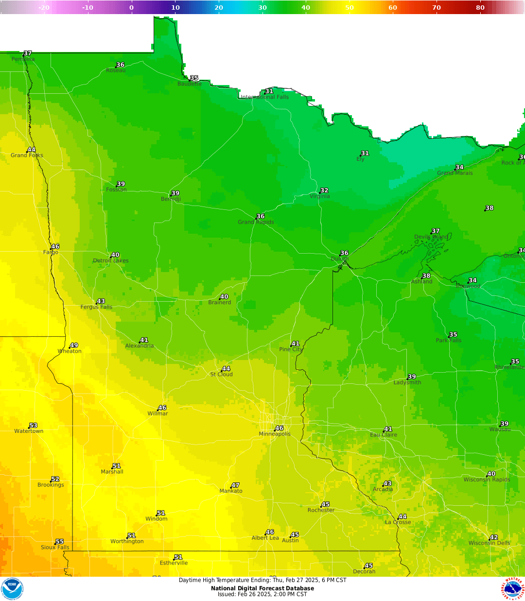
The main show will stay north of Interstate 94, as temperatures cool down into the 20s and 30s.

Windy Thursday and Friday
As northwest winds pick up on Thursday, temperatures will cool slightly, reaching highs in the mid-40s, with some areas in the southwestern corner hitting the 50s.
Turn Up Your Support
MPR News helps you turn down the noise and build shared understanding. Turn up your support for this public resource and keep trusted journalism accessible to all.
Our strongest winds will arrive on Friday, with northwest winds ranging from 15 to 25 mph and gusts exceeding 40 mph. Some areas in western Minnesota may experience gusts surpassing 50 mph.

We’ll end the work week with temperatures in the upper 40s to low 50s with partly sunny skies for Friday.

Another disturbance, this one stronger, will bring some accumulating snowfall to the northeast regions of the state Thursday night through Friday.

Our snow depth has shifted significantly in just one week, with central to southern Minnesota now reporting zero snow depth.

Unfortunately for winter enthusiasts, long-range models are showing warmer temperatures ahead with no significant snow makers on the horizon.
