

Snow totals from northern Minnesota's weekend storm
North Shore received more than 6 inches of snow

Go Deeper.
Create an account or log in to save stories.
Like this?
Thanks for liking this story! We have added it to a list of your favorite stories.
Northern Minnesota found itself once again impacted by the latest spring storm system passing through the Upper Midwest, with snow totals ranging from a few inches to nearly a foot.
This past weekend northern Minnesota saw a mix of freezing rain, rain and snow. Snow started to pile up in areas, and we saw some impressive snow totals:
Hovland, 10.7 inches
International Falls, 10.4 inches
Grand Marais, 9.5 inches
Island View, 9.0 inches
Kabetogama, 8.7 inches
Ely, 7.3 inches
Crookston, 7.3 inches
Lutsen, 6.4 inches
Warroad, 6.0 inches
Orr, 5.1 inches
A radar image from 7 a.m. Sunday shows the rain showers in southern Minnesota, a dry slot in central Minnesota, and a wintry mix in the northern part of the state.

Turn Up Your Support
MPR News helps you turn down the noise and build shared understanding. Turn up your support for this public resource and keep trusted journalism accessible to all.
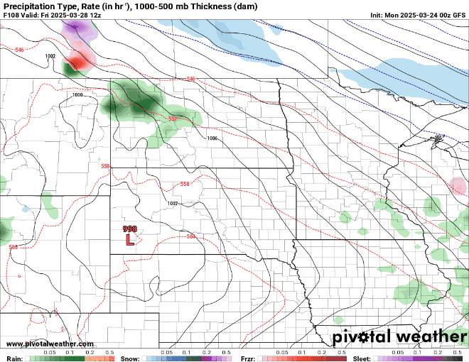
Out like a lamb?
March certainly roared in like a lion with a snowstorm and blizzard on March 4 and 5. Will the last week be quiet and calm, like a lamb? Short answer: No, but there may still be some quieter days ahead before the month ends.
An active northwestern flow pattern aloft will bring several chances for precipitation, with one system arriving Monday night into Tuesday and another on Friday.
The first system will bring minimal precipitation, mostly light rain, with a few flakes mixed in at times. Due to very dry conditions, it will be difficult to extract much moisture from this system.

Our second system on Friday will pack a bit more of a punch with higher moisture levels. Accumulating snowfall is possible in parts of Minnesota, while warmer temperatures in the south will keep the precipitation as rain.
The broader outlook from the National Oceanic and Atmospheric Administration’s Climate Prediction Center indicates above-average temperatures through early April, along with above-average chances for precipitation.


